


Scandia Voting District, Washington County, Minnesota
About
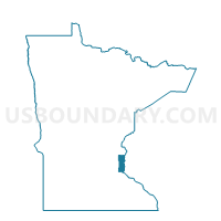
Outline

Summary
| Unique Area Identifier | 604783 |
| Name | Scandia Voting District |
| County | Washington County |
| State | Minnesota |
| Area (square miles) | 39.82 |
| Land Area (square miles) | 34.80 |
| Water Area (square miles) | 5.02 |
| % of Land Area | 87.40 |
| % of Water Area | 12.60 |
| Latitude of the Internal Point | 45.25153550 |
| Longtitude of the Internal Point | -92.83340930 |
Maps


Graphs
Select a template below for downloading or customizing gragh for Scandia Voting District, Washington County, Minnesota


Neighbors
Neighoring Voting District (by Name) Neighboring Voting District on the Map
- Chisago Lake Twp. (S) Voting District, Chisago County, MN
- FARMINGTON - T 1 Voting District, Polk County, WI
- FARMINGTON - T 2 Voting District, Polk County, WI
- Forest Lake P-3, Washington County, MN
- Forest Lake P-4, Washington County, MN
- Franconia Twp. Voting District, Chisago County, MN
- Hugo W-2 P-2, Washington County, MN
- Marine On St. Croix Voting District, Washington County, MN
- May Twp. Voting District, Washington County, MN
Top 10 Neighboring County Subdivision (by Population) Neighboring County Subdivision on the Map
- Forest Lake city, Washington County, MN (18,375)
- Hugo city, Washington County, MN (13,332)
- Chisago Lake township, Chisago County, MN (4,656)
- Scandia city, Washington County, MN (3,936)
- May township, Washington County, MN (2,776)
- Farmington town, Polk County, WI (1,836)
- Franconia township, Chisago County, MN (1,805)
- Marine on St. Croix city, Washington County, MN (689)
Top 10 Neighboring Place (by Population) Neighboring Place on the Map
- Forest Lake city, MN (18,375)
- Hugo city, MN (13,332)
- Scandia city, MN (3,936)
- Marine on St. Croix city, MN (689)
Top 10 Neighboring Unified School District (by Population) Neighboring Unified School District on the Map
- Stillwater Area Public School District, MN (59,454)
- Forest Lake Public School District, MN (45,564)
- Chisago Lakes School District, MN (21,316)
- Osceola School District, WI (9,074)
- Franconia Public School District, MN (178)
Top 10 Neighboring State Legislative District Lower Chamber (by Population) Neighboring State Legislative District Lower Chamber on the Map
- Assembly District 28, WI (59,273)
- State House District 17B, MN (49,009)
- State House District 52A, MN (47,548)
- State House District 52B, MN (42,649)
Top 10 Neighboring State Legislative District Upper Chamber (by Population) Neighboring State Legislative District Upper Chamber on the Map
- State Senate District 10, WI (192,662)
- State Senate District 17, MN (94,415)
- State Senate District 52, MN (90,197)
Top 10 Neighboring 111th Congressional District (by Population) Neighboring 111th Congressional District on the Map
- Congressional District 6, MN (759,478)
- Congressional District 7, WI (689,279)
- Congressional District 8, MN (660,342)
Top 10 Neighboring Census Tract (by Population) Neighboring Census Tract on the Map
- Census Tract 702.03, Washington County, MN (7,734)
- Census Tract 9608, Polk County, WI (6,465)
- Census Tract 701.06, Washington County, MN (6,262)
- Census Tract 1106, Chisago County, MN (4,747)
- Census Tract 701.05, Washington County, MN (4,238)
- Census Tract 702.05, Washington County, MN (3,936)
- Census Tract 702.06, Washington County, MN (3,465)
Top 10 Neighboring 5-Digit ZIP Code Tabulation Area (by Population) Neighboring 5-Digit ZIP Code Tabulation Area on the Map
- 55025, MN (23,244)
- 55038, MN (20,816)
- 55045, MN (7,577)
- 54020, WI (7,260)
- 55013, MN (6,541)
- 55073, MN (3,237)
- 55047, MN (2,528)
- 55074, MN (2,222)